


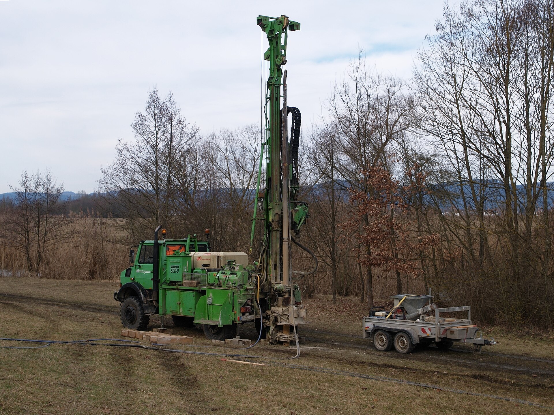
A well is the one part of an off-grid build priced by the foot and measured only after the money is spent. The driller quotes a rate, brings a rig, and the hole decides the invoice.
Most of that answer is already written down, for tens of thousands of wells within a few counties of yours, in a federal file anyone can query. The table below turns it into two numbers per state: how deep the drillers went, and what that depth costs at 2025 per-foot rates.
USGS Circular 1441, the 2015 national water-use census, counted 42.5 million people in the United States, 13 percent of the population, supplying their own domestic water, and 98 percent of that supply came out of the ground.
Key number
Across the 46 states with enough driller-reported records to publish, the median completed well depth runs from 70 feet in Massachusetts to 350 feet in Arizona. At the 2025 complete-installation rate of $30 to $80 a foot, that is roughly $2,000–$5,500 of finished well in one state and $10,500–$28,000 in the other, for the same house, the same family and the same daily gallons.
The Two Depths a Well Has
Drilled depth is the number on the invoice: feet of hole, feet of casing, days of rig time, fixed the day the crew packs up. Water level is the number on the electricity bill, because a submersible lifts from wherever the surface sits while it runs.
The two come apart most sharply in hard rock. A New England bedrock well may be 300 feet deep and stand full to within 40 feet of the surface, because the hole is a storage tank cut through rock that yields slowly. A basin well in the Southwest may be the same depth with water 200 feet down. Same bill, very different pump.
The pump does not care how much rock is under it. It cares about total dynamic head: the lift from the pumping water level to the surface, plus the pressure the tank is set to hold, plus friction. Water weighs 0.4335 pounds per square inch per foot of column, so a tank cutting out at 50 psi asks for about 115 feet of head before a drop has left the well.
Put those together and the pump’s electrical size falls out of arithmetic. Water power is flow times head times the weight of water, and a submersible turns 35 to 50 percent of what enters the wires into it.
| Lift to pumping level | Total head with a 50 psi tank | Water power at 10 GPM | Input at the wires | Pump class |
|---|---|---|---|---|
| 50 ft | 165 ft | 311 W | 620–890 W | ½ HP |
| 100 ft | 215 ft | 405 W | 810–1,160 W | ½–¾ HP |
| 200 ft | 315 ft | 594 W | 1,190–1,700 W | ¾–1 HP |
| 300 ft | 415 ft | 782 W | 1,560–2,230 W | 1–1½ HP |
| 500 ft | 615 ft | 1,159 W | 2,320–3,310 W | 1½–2 HP |
| Lift to pumping level | Total head with a 3.5 bar tank | Water power at 38 L/min | Input at the wires | Pump class |
|---|---|---|---|---|
| 15 m | 51 m | 315 W | 630–900 W | 0.37 kW |
| 30 m | 66 m | 408 W | 820–1,170 W | 0.37–0.55 kW |
| 60 m | 96 m | 594 W | 1,190–1,700 W | 0.55–0.75 kW |
| 90 m | 126 m | 779 W | 1,560–2,230 W | 0.75–1.1 kW |
| 150 m | 186 m | 1,150 W | 2,300–3,290 W | 1.1–1.5 kW |
Those running watts are the easy half. A standard submersible draws roughly three times its running figure for the first fraction of a second of every start, and that surge is what an off-grid inverter has to clear. Feed your lift and flow into the well pump calculator for the surge, the daily watt-hours and the panels that refill them.
Carry one consequence into a land search: a deep well is a capital problem, a deep water level is a running problem. The first is a check written once; the second follows the pump for its whole life, which is why water depth belongs in a buying decision beside the price of the land itself.
Depth by State, From the Driller’s Own Log
Every depth below comes from one federal file: the site inventory inside the U.S. Geological Survey National Water Information System, retrieved 2 September 2026. Each record carries a code for where its depth came from, and this table keeps only wells whose depth the driller reported — records that came off a completion report, the population that most resembles a house well.
Depths under 5 feet and over 3,000 feet are dropped as clerical errors or industrial holes, and a state is listed only if at least 300 driller-reported depths survive. That leaves out Maine, Michigan, Missouri and Vermont, whose own state well-log databases are the place to look. Sorted deepest first; any column heading re-sorts.
| State | Census division | Median depth | Median, metric | Middle half of wells | Cost at the median | Wells logged |
|---|---|---|---|---|---|---|
| Arizona | Mountain | 350 ft | 107 m | 166–648 ft | $10,500–$28,000 | 15,763 |
| Texas | West South Central | 330 ft | 101 m | 200–511 ft | $10,000–$26,500 | 9,078 |
| New Hampshire | New England | 300 ft | 91 m | 190–406 ft | $9,000–$24,000 | 32,056 |
| Georgia | South Atlantic | 270 ft | 82 m | 165–456 ft | $8,000–$21,500 | 4,335 |
| Colorado | Mountain | 266 ft | 81 m | 155–319 ft | $8,000–$21,500 | 2,188 |
| Hawaii | Pacific | 266 ft | 81 m | 84–534 ft | $8,000–$21,500 | 724 |
| South Carolina | South Atlantic | 260 ft | 79 m | 150–400 ft | $8,000–$21,000 | 2,621 |
| Utah | Mountain | 253 ft | 77 m | 142–430 ft | $7,500–$20,000 | 2,799 |
| Virginia | South Atlantic | 250 ft | 76 m | 140–430 ft | $7,500–$20,000 | 2,213 |
| West Virginia | South Atlantic | 240 ft | 73 m | 150–340 ft | $7,000–$19,000 | 319 |
| New Mexico | Mountain | 231 ft | 70 m | 102–405 ft | $7,000–$18,500 | 765 |
| Oregon | Pacific | 224 ft | 68 m | 108–422 ft | $6,500–$18,000 | 5,807 |
| Tennessee | East South Central | 222 ft | 68 m | 115–430 ft | $6,500–$18,000 | 528 |
| Nevada | Mountain | 202 ft | 62 m | 110–390 ft | $6,000–$16,000 | 4,133 |
| Alabama | East South Central | 200 ft | 61 m | 110–320 ft | $6,000–$16,000 | 944 |
| California | Pacific | 200 ft | 61 m | 104–397 ft | $6,000–$16,000 | 11,521 |
| North Carolina | South Atlantic | 200 ft | 61 m | 120–340 ft | $6,000–$16,000 | 3,624 |
| North Dakota | West North Central | 182 ft | 55 m | 114–250 ft | $5,500–$14,500 | 606 |
| New York | Middle Atlantic | 178 ft | 54 m | 95–298 ft | $5,500–$14,000 | 12,020 |
| Maryland | South Atlantic | 167 ft | 51 m | 100–300 ft | $5,000–$13,500 | 10,868 |
| Nebraska | West North Central | 167 ft | 51 m | 87–262 ft | $5,000–$13,500 | 3,036 |
| Connecticut | New England | 162 ft | 49 m | 120–245 ft | $5,000–$13,000 | 707 |
| Idaho | Mountain | 160 ft | 49 m | 90–300 ft | $5,000–$13,000 | 10,592 |
| Oklahoma | West South Central | 160 ft | 49 m | 98–250 ft | $5,000–$13,000 | 874 |
| Arkansas | West South Central | 156 ft | 48 m | 110–344 ft | $4,500–$12,500 | 719 |
| Illinois | East North Central | 142 ft | 43 m | 70–265 ft | $4,500–$11,500 | 577 |
| Louisiana | West South Central | 140 ft | 43 m | 95–265 ft | $4,000–$11,000 | 6,705 |
| Minnesota | West North Central | 140 ft | 43 m | 58–307 ft | $4,000–$11,000 | 1,812 |
| Iowa | West North Central | 139 ft | 42 m | 42–320 ft | $4,000–$11,000 | 1,404 |
| Wisconsin | East North Central | 134 ft | 41 m | 77–230 ft | $4,000–$10,500 | 5,122 |
| Mississippi | East South Central | 132 ft | 40 m | 105–392 ft | $4,000–$10,500 | 329 |
| South Dakota | West North Central | 126 ft | 38 m | 50–280 ft | $4,000–$10,000 | 9,739 |
| Washington | Pacific | 120 ft | 37 m | 65–220 ft | $3,500–$9,500 | 69,270 |
| New Jersey | Middle Atlantic | 118 ft | 36 m | 70–205 ft | $3,500–$9,500 | 5,776 |
| Pennsylvania | Middle Atlantic | 115 ft | 35 m | 70–200 ft | $3,500–$9,000 | 15,766 |
| Kentucky | East South Central | 106 ft | 32 m | 48–175 ft | $3,000–$8,500 | 721 |
| Montana | Mountain | 100 ft | 30 m | 55–189 ft | $3,000–$8,000 | 2,290 |
| Florida | South Atlantic | 98 ft | 30 m | 22–220 ft | $3,000–$8,000 | 1,421 |
| Rhode Island | New England | 97 ft | 30 m | 57–144 ft | $3,000–$8,000 | 653 |
| Kansas | West North Central | 90 ft | 27 m | 48–193 ft | $2,500–$7,000 | 725 |
| Alaska | Pacific | 89 ft | 27 m | 55–150 ft | $2,500–$7,000 | 5,907 |
| Wyoming | Mountain | 82 ft | 25 m | 39–205 ft | $2,500–$6,500 | 470 |
| Ohio | East North Central | 81 ft | 25 m | 56–112 ft | $2,500–$6,500 | 1,464 |
| Indiana | East North Central | 71 ft | 22 m | 29–148 ft | $2,000–$5,500 | 2,273 |
| Massachusetts | New England | 70 ft | 21 m | 40–133 ft | $2,000–$5,500 | 2,241 |
| Delaware | South Atlantic | 60 ft | 18 m | 25–120 ft | $2,000–$5,000 | 327 |
Cost column: state median depth times the $30 and $80 per foot ends of the 2025 complete-installation band. Download data.csv for the 90th percentile and citations.
The deep end is not the map of dry country most people expect. Arizona at 350 feet, Texas at 330 and New Hampshire at 300 land in the same band for opposite reasons: two because the water table in a thick sedimentary basin is genuinely far down, one because granite yields so little per foot that the only way to fill a tank is to keep drilling for fractures. The shallow end — Massachusetts at 70 feet, Indiana at 71, Ohio at 81, Kansas at 90 — is glacial sand and gravel or shallow alluvium, where a well finds what it needs before the rig has warmed up.
Read the middle-half column before you budget. Ohio’s wells run 56 to 112 feet, which makes a quote fairly predictable. Arizona’s run 166 to 648 feet, putting more than $14,000 between two neighbors at the cheapest per-foot rate.
Where the Deep States Sit
The same medians laid on the country. Alaska and Hawaii are drawn at a different scale, and the four states and the District of Columbia without enough driller records stay unshaded.
The pattern is geological rather than climatic. The deep band traces the sedimentary basins of the Southwest and the crystalline uplands of northern New England, two settings with nothing in common except that neither gives up water in the first hundred feet.
What a Foot of Hole Costs
Two per-foot rates get quoted for the same job. Drilling alone is the cheaper one; a complete installation, which is what a homeowner receives, carries casing, pump, wiring and paperwork.
The figures below are from the HomeGuide well drilling cost guide, written 30 July 2025, which tracks contractor estimates rather than list prices. Drilling alone runs $20 to $30 a foot, a complete installation $30 to $80, difficult ground past $100. Its national average for a finished residential well is $10,500, in a typical range of $6,000 to $16,000 at 200 feet.
| Line item | Typical cost, 2025 | Scales with depth |
|---|---|---|
| Drilling | $20–$30 per foot | Yes |
| PVC casing | $7–$11 per foot | Yes, over the cased section |
| Steel casing | $30–$130+ per foot | Yes, over the cased section |
| Submersible pump | $400–$2,500 | Only in steps, as the class changes |
| Pressure tank | $800–$1,500 | No |
| Electrical wiring and connections | $1,000–$3,000 | Slightly, through the drop cable |
| Permit | $350–$700+ | No |
| Inspection after installation | $250–$550 | No |
| Laboratory water test | $100–$350 | No |
Add the items that do not move with depth and the floor is $2,900 to $8,600 before the rig turns, which is why a 60-foot well never costs a fifth of a 300-foot one.
British figures come from the Checkatrade borehole cost guide, whose estimates are prepared by chartered surveyors and members of the Chartered Institute of Building, last updated May 2024. It prices a complete borehole — drilling, lining, pump, chamber and pressure vessel — at £10,000 to £15,000 against what it calls an average British borehole depth of 60 meters.
| Line item | Typical cost, 2024 | Scales with depth |
|---|---|---|
| Hydrogeologist’s survey before drilling | £220–£1,000 | No |
| Drilling, lining, pump, chamber and pressure vessel | £10,000–£15,000 at 60 m | Yes, over the drilled section |
| Complete installed borehole | £10,220–£16,000 | — |
| Running cost, pump electricity and filters | about £150 a year at 60 m | Yes, through the lift |
Casing is the line that surprises people: at the top of its range a steel-cased section costs more per foot than the drilling that made it. Ask, before signing, what happens to the price if the driller has to case deeper than planned, because the per-foot rate itself rises with hard rock, with distance from the yard, and with a hole drilled twice because the first came up dry.
Europe Keeps the Same Record Under Different Names
There is no European equivalent of the table above, because there is no single European well file. Each country collects its own logs under its own duty to report. The method still travels: find the national record, filter to your commune or parish, and read the depths your neighbors drilled.
| Country | National well record | What it holds |
|---|---|---|
| United Kingdom | British Geological Survey borehole records and GeoIndex | Scanned driller logs for onshore boreholes, searchable on a map |
| Ireland | Geological Survey Ireland groundwater wells and springs | Mapped wells and springs published as open data |
| France | BRGM Banque du Sous-Sol | More than 700,000 subsurface works and over two million scanned documents |
| Netherlands | TNO DINOloket subsurface data portal | Borehole and subsurface data for the whole country |
| Denmark | GEUS Jupiter national well database | More than 280,000 wells and 35,000 abstraction plants, open to the public |
France shows how a file like that gets filled. The mining code has required the declaration of any subsurface work deeper than 10 meters since 1958, and since 2003 the environment code has required a Banque du Sous-Sol reference on the report for any work drilled to find, monitor or abstract groundwater. Sixty-eight years of that duty is what a 700,000-record database looks like.
The rules on top of these records differ more than the geology does. In England, abstraction above 20 cubic meters a day needs an Environment Agency license, and a household is nowhere near that threshold.
Ireland sets a construction standard instead. Environmental Protection Agency Advice Note No. 14, issued 11 September 2013, specifies a six-inch pump chamber casing in a ten-inch hole, grouted from the bottom up, for a house supply. That grout is worth paying for anywhere: it keeps surface water, and whatever is dissolved in it, from running down the outside of the pipe into what you are about to drink.
Method, Sources and Refresh
Depths were pulled state by state from the USGS site service, filtered to site type GW, then to records whose depth source code is D, meaning the driller reported it. Values below 5 feet or above 3,000 feet were discarded and a state published only where 300 records survived. The cost column multiplies the median by the $30 and $80 ends of the complete-installation band.
Two limits are worth stating plainly. The inventory catalogs wells the survey has recorded rather than every private well, and it mixes domestic, stock, irrigation and public supply wells, which pulls a state median somewhat deeper than a purely domestic one would sit.
The head arithmetic uses 0.4335 pounds per square inch per foot of water column, water power as flow times head times 9,800 newtons per cubic meter, and a wire-to-water band of 35 to 50 percent.
Verified September 2026. Every state figure recomputed from the USGS site service on 2 September 2026 and every cost figure checked against its source page on that date. Refresh: annual. data.csv carries all 46 states with the 25th, 50th, 75th and 90th percentiles, the record count, the derived cost band and a source citation on every row. USGS data is a United States government work in the public domain; this compilation is free to reuse with credit to Grid CEO.
Common questions
Should I budget for the median depth?
Budget the 75th percentile and be pleased if the rig stops early. Half a state’s wells are deeper than its median by definition, and a well that comes up short is drilled again rather than refunded.
Why is a granite state as deep as a desert state?
Because depth answers two questions. In a sedimentary basin you drill until you reach the water table. In fractured rock the water table can be shallow while the rock yields almost nothing, so you keep drilling to catch fractures. New Hampshire and Arizona reach 300 and 350 feet from opposite directions.
Does a deeper well cost more to run?
Only if the water in it stands deeper. A 400-foot well standing full to 50 feet costs less to run than a 150-foot well standing at 120, because the pump lifts from the water surface. Storage sizing is what lets the pump run on your schedule instead of whenever a tap opens.
Can I find the depth of the wells on my own road?
Usually, and it is the most useful hour of research before you buy. Most states publish a well-log database searchable by township or parcel; in Europe the equivalent is the national record named above. Still choosing between a well, a spring and a roof? Start with the water source comparison.
Sources: U.S. Geological Survey National Water Information System site service, retrieved 2 September 2026; USGS Circular 1441, Estimated Use of Water in the United States in 2015; HomeGuide well drilling cost guide, 30 July 2025; Checkatrade borehole drilling cost guide, costs updated May 2024; UK Government water abstraction licensing guidance; BRGM Banque du Sous-Sol on InfoTerre; GEUS national well database Jupiter; Environmental Protection Agency (Ireland) Drinking Water Advice Note No. 14, 11 September 2013.
Keep reading
- The water and filtration hub, where the well sits inside the rest of the supply
- The well pump calculator, to turn a lift and a flow into surge, watt-hours and panels
- The 120V and 240V split-phase guide, for the voltage gate most deep-well pumps sit behind